Key takeaways
- Parrot Sequoia and similar legacy multispectral sensors: Older but still-used payload sensors some operations already own; worth checking against current software compatibility before investing in new hardware.
- Satellite-based vegetation index services: For very large operations, satellite imagery subscriptions can supplement or substitute for drone flights on a routine schedule, trading resolution for lower per-acre operational effort.
- Agras-series application drones with mapping add-ons: Farms already using DJI’s Agras spraying drones should check whether their existing fleet supports an add-on sensor before buying a completely separate multispectral platform.
Large commercial farms analyzing crop health across hundreds of acres generally do best with a fixed-wing mapping platform carrying a dedicated multispectral sensor such as a MicaSense payload, while smaller farms or agronomy consultants covering individual fields often get enough value from an integrated multirotor like the DJI Mavic 3 Multispectral. The choice mainly comes down to acreage, how often fields need to be flown, and whether the operation needs a dedicated sensor specialist or a simpler all-in-one package.
As an Amazon Associate, we earn from qualifying purchases made through links on this page.
What Multispectral Imaging Actually Measures
Multispectral drones carry sensors that capture light outside the visible spectrum, typically including red-edge and near-infrared bands, which agronomists use to calculate vegetation indices like NDVI (Normalized Difference Vegetation Index). These indices highlight differences in plant health, water stress, and nitrogen levels that are not visible to the naked eye or a standard RGB camera, letting growers spot problem areas in a field before visible symptoms appear. The sensor and the processing software work together: raw multispectral imagery needs specialized agricultural analysis software to become a usable field map, so the two should be evaluated as a pair rather than separately.
Integrated Multirotor Platforms: DJI Mavic 3 Multispectral
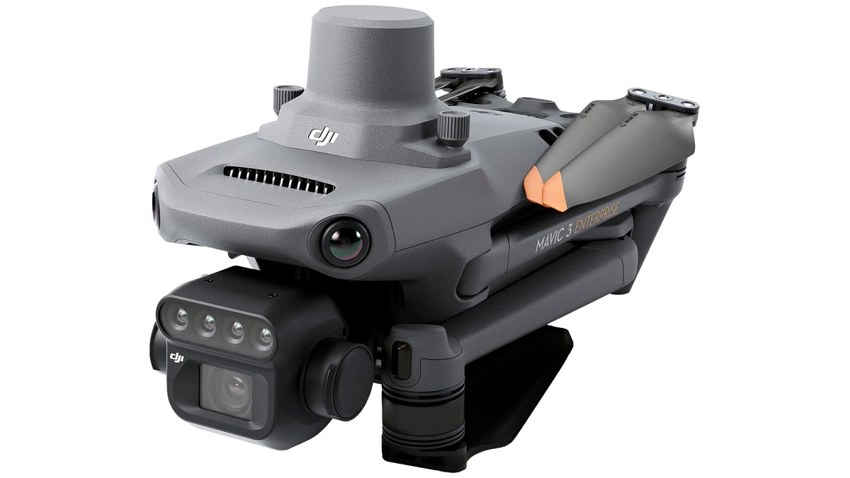
The DJI Mavic 3 Multispectral pairs a standard RGB camera with a four-band multispectral sensor in a single compact airframe, which the maker positions as a simplified option for farms and agronomy services that do not want to manage a separate payload and drone combination. Reviewers note its portability and relatively quick setup as advantages for operators covering multiple smaller fields in a day, and DJI’s Terra software is built to process its own multispectral output into index maps. The compromise is coverage efficiency compared with dedicated mapping platforms, since a multirotor still flies slower and covers less ground per battery than a fixed-wing design.
Dedicated Sensor Payloads: MicaSense RedEdge-P and Altum
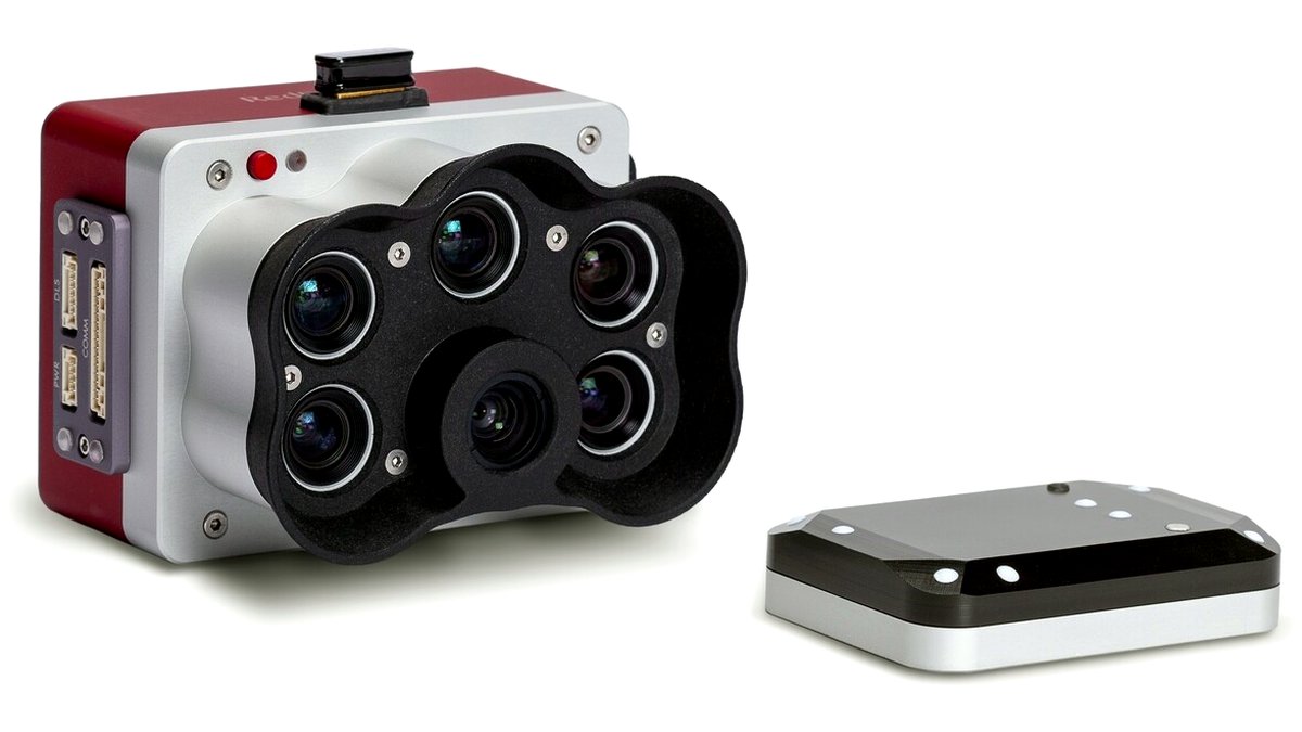
MicaSense sensors, including the RedEdge-P and Altum-PT lines, are built specifically for agricultural and research-grade multispectral capture and are typically mounted on a separate drone platform rather than sold as a complete aircraft. The company states these sensors capture multiple discrete spectral bands with radiometric calibration, which supports more scientifically consistent index calculations across different flights and lighting conditions than a simpler integrated sensor. This approach suits agronomy researchers, large farm operations, and service providers who need the most defensible data for input decisions, but it requires pairing the sensor with a compatible drone and investing in the calibration and processing workflow MicaSense recommends.
Fixed-Wing Platforms for Large-Acreage Coverage
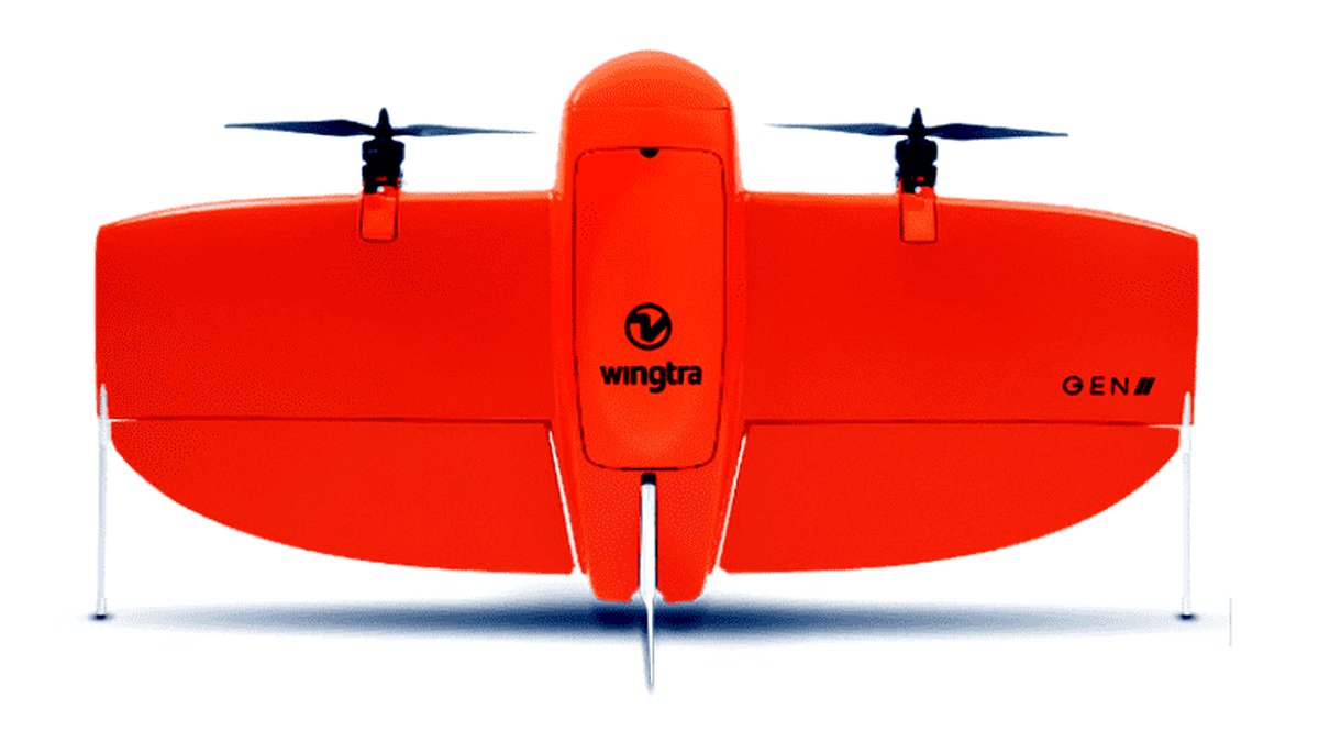
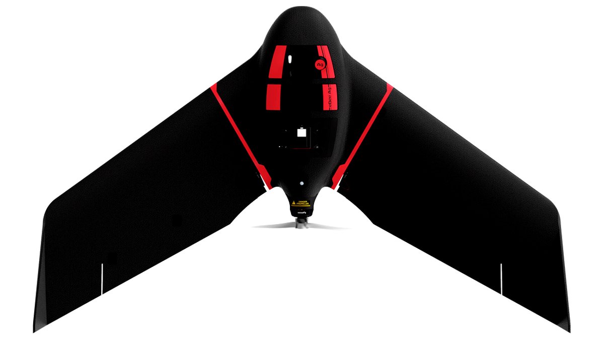
Fixed-wing mapping drones, including platforms from WingtraOne and senseFly’s eBee Ag line, can carry a MicaSense-style payload while covering far more acreage per flight than any multirotor. These platforms suit large row-crop operations and agricultural service providers flying many fields in a single day, where the time saved on coverage per battery meaningfully reduces the number of flights needed to map an entire operation. The tradeoff mirrors other fixed-wing use cases: they need a clear launch area and are a poor fit for small, irregularly shaped, or obstacle-dense fields.
Agricultural Analysis Software: Pix4Dfields and DJI Terra
Pix4Dfields is built specifically for agricultural multispectral workflows, with tools the company states are designed for generating index maps, prescription maps for variable-rate application, and field zoning directly from drone imagery. DJI Terra handles processing for DJI’s own integrated sensors and ties closely to the Mavic 3 Multispectral’s data format, which simplifies the pipeline for farms standardized on that one platform. Operations using a MicaSense sensor on a third-party airframe often pair it with Pix4Dfields or similar agriculture-focused software rather than a drone manufacturer’s own processing tool, since the sensor is not tied to one specific airframe brand.
At a Glance: Multispectral Agriculture Drone Options
| Platform | Best For | Key Stated Specs | Limits |
|---|---|---|---|
| DJI Mavic 3 Multispectral | Smaller farms, quick multi-field days | Integrated RGB + 4-band multispectral sensor, compact airframe | Slower per-flight coverage than fixed-wing platforms |
| MicaSense RedEdge-P / Altum-PT | Research-grade, defensible data | Maker lists radiometric calibration, multiple discrete bands | Needs a separate compatible airframe and calibration workflow |
| Fixed-wing (WingtraOne, eBee Ag) | Large-acreage row-crop operations | Long per-flight coverage, can carry dedicated sensor payloads | Needs open launch area, less suited to small or irregular fields |
| Pix4Dfields software | Index and prescription maps | Agriculture-specific zoning and variable-rate tools, per maker | Separate license cost from the drone hardware |
Pick X If…
| If You… | Choose |
|---|---|
| Manage several smaller fields and want a simple all-in-one kit | DJI Mavic 3 Multispectral with DJI Terra |
| Need the most scientifically consistent data for research or inputs | A MicaSense sensor on a compatible airframe with Pix4Dfields |
| Cover large row-crop acreage and need maximum area per flight | A fixed-wing platform like WingtraOne or eBee Ag |
| Are already standardized on DJI equipment across the farm | DJI Mavic 3 Multispectral for consistency with existing workflow |
Fit and Operational Notes
Multispectral index accuracy depends heavily on consistent lighting and proper sensor calibration at the start of each flight, which most makers address with a calibration panel or ambient light sensor; skipping that step can make index values inconsistent between flights. Flight timing also matters agronomically, since indices like NDVI are typically most useful when compared against the same field over time or against similar growth-stage fields, rather than as a single isolated reading. Operators should also confirm local aviation rules on remote pilot certification and any restrictions near populated areas before planning routine agricultural flights.
Alternatives Worth Considering
- Parrot Sequoia and similar legacy multispectral sensors: Older but still-used payload sensors some operations already own; worth checking against current software compatibility before investing in new hardware.
- Satellite-based vegetation index services: For very large operations, satellite imagery subscriptions can supplement or substitute for drone flights on a routine schedule, trading resolution for lower per-acre operational effort.
- Agras-series application drones with mapping add-ons: Farms already using DJI’s Agras spraying drones should check whether their existing fleet supports an add-on sensor before buying a completely separate multispectral platform.
Frequently Asked Questions
How often should a field be flown with a multispectral drone during a growing season?
Agronomists commonly recommend flying at key growth stages rather than on a fixed daily or weekly schedule, since the most useful comparisons come from tracking change over a crop’s development. The exact cadence depends on the crop type and what decisions the data will inform, such as irrigation scheduling or input application, so growers should plan flights around those specific decision points rather than an arbitrary interval.
Can multispectral data replace soil testing or scouting?
No; multispectral imagery highlights where plant stress is occurring but does not identify the specific cause, such as a nutrient deficiency, pest pressure, or water issue. Agronomists typically use the imagery to target where to scout or sample on the ground, treating it as a tool that focuses field visits rather than a replacement for them.
Do multispectral sensors need recalibration over time?
Makers of research-grade sensors like MicaSense generally recommend periodic calibration checks and provide calibration panels for use before each flight, since sensor drift can affect the consistency of index values. Operators relying on data for input decisions should follow the manufacturer’s stated calibration schedule rather than assuming a sensor stays accurate indefinitely without checks.
Is an integrated sensor like the Mavic 3 Multispectral accurate enough for professional agronomy work?
The maker lists calibrated bands and radiometric capability suitable for generating standard vegetation indices, and many agronomy service providers do use integrated platforms for routine field monitoring. For research publications or high-stakes input decisions requiring the most rigorous data, some professionals still prefer dedicated sensors like MicaSense, so the right choice depends on how the data will ultimately be used.
What file formats and software are needed to process multispectral drone imagery?
Multispectral sensors typically output multiple band images per capture point that need stitching and calibration through dedicated software such as Pix4Dfields, DJI Terra, or similar agriculture-focused tools rather than standard photo editing software. Operators should confirm their chosen software explicitly supports their sensor’s specific band configuration and output format before purchasing, since not all agricultural software reads every sensor’s raw files.
Can one drone and sensor combination work across different crop types?
Generally yes, since vegetation indices like NDVI apply across many crop types, though the specific index thresholds considered healthy or stressed vary by crop and growth stage. Agronomists typically build crop-specific reference ranges over a season or two of data rather than applying a single universal standard across every crop a farm grows.